Home,
Hiking Routs
PAGARI' VALMASQUE
VIA
COLLE DELL'AGNEL
AND COLLET OUEST DE LA CHARNASSÈRE
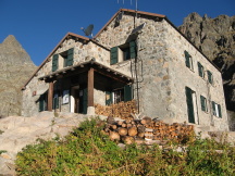
From Rifugio Pagarì climb down following
the main path that leads to San Giacomo until this bears left before shifting to
the valley bottom. Here at an altitude of 2300 metres you find a small signpost
(30 minutes). Leave the main path and turn right following the red paint sings.
After a few minutes there is a creek (you are still at 2300 metres of altitude)
and look for two signposts on the rock, one indicating the way for Lago Bianco
dell'Agnel (40 minutes) and Colle dell'Agnel through the Lago Bianco (1h 20m),
the other signalling the direct way to Colle dell'Agnel (1 hour). Follow the
latter. The track to follow is indicated by red signs for roughly 15 minutes
(and reach the altitude of 2270 metres). Climb up to the Lago Bianco (1 hour),
2297 metres of altitude. Keep following the red paint signs along the lake until
the lake is on your left and reaching a slightly exposed rock spur. After the
lake, once this is almost behind you, keep on following the red signs among
rocks and boulders. Be aware that gradually the boulders get bigger and the path
winds on steep slopes, making this itinerary only suitable for expert hikers
(with reasonably heavy backpacks). Once you get to the Colle dell'Agnel (1h 45m,
at an altitude of 2564 metres) there are two options in order to get to the
Collet Ouest (West) de la Charnassère.
|
 |
1)
On a clear day with good visibility you could climb up the Colle
dell'Agnel from the right side (facing the direction to France) and follow the
red paint signs leading to French side, on the right of the col and at altitude
gap of only a few metres over the col. Be aware that this path is characterised
by exposed grassy ledges and stony slopes at times unstable. Follow red paint
signs and kerns up to Collet Ouest de la Charnassère, at the altitude of 2722
metres (30 minutes from Colle dell'Agnel). |
2)
If the weather is humid then it is recommended to stay on the left of the
Colle dell'Agnel. Follow red signs and kerns until while climbing down towards
an earthy strip, that you need to cross in order to pass the two lakes. Then
follow the recurring kerns that lead up through grassy humps and massive stone
heaps to the Collet Ouest de la Charnassère (1h 15m form Colle dell'Agnel)
|
 |
The worst is over. Head to the higher
small lake of the two you have in sight (the Lac Lusière), following the
track signalled by the kerns. Be aware that after 10 minutes from the Collet
the main kerns bend left to lead to the Lake Gelè (the largest and the lower
of the lakes). Once you have reached the Lac Lusière, circumnavigate it
until it is on your right, at 2639 metres of altitude (30 minutes from the
Collet). Here look out for a taller kern that indicates the fork for Collet
O Charnassère (the one you are coming from) and Pas de la Fous: follow the
kerns that lead down along the wide canyon, in direction to the Refuge
Valmasque. |
|
 |
Climb down
through the canyon and follow the numerous kerns, down to an altitude of 2579
metres (40 minutes from the Collet), where it ends with grassy ledges. You
finally get to an easy small path that bears left. Soon you start seeing the
Refuge de Valmasque, 1h 30m away, downhill. From here you are also able to see
the dam of Lac Noir that you are soon going to pass by. After the demanding
stony slopes you can now enjoy a pleasant path all the way down to the Refuge de
Valmasque (4h 25m or 5h 10, for itinerary 1 and 2 respectively).
|
Home,
Hiking Routs